Showing posts with label Richtersveld. Show all posts

Wednesday, November 30, 2016

11th CGS Field School - Mapping the Gariep Belt

And so, finally we have completed another highly successful CGS Field School. This was arguably the most grueling and challenging field school yet. It all came to an end where our team set out to map in the Gariep fold and thrust belt. This of course represents a period spanning the existence of the Supercontinents' Rodinia and Gondwana. Read more about the Gariep Belt here.

Rocks

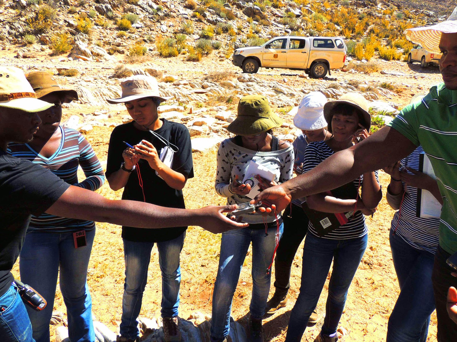
The team was split into three separate groups and allocated three different maps across the southern portion of the Gariep Belt. Each sheet was unique in its own right and required varying degrees of focus from the various groups. Throughout the mapping period the teams were exposed to several different rocks types characteristic of this region. Some of these include:

TL: Sheared 1,800 Ma Vioolsdrift (Richtersveld Suite) grano-diorite, note the development of spaced cleavage; TR: Magnetite-bearing quartzite of the Stinkfontein Group; ML: Kaigas diamictite with characteristic carbonate clasts; MR: Marble of the Hilda Subgroup; BL: Sheared Numees diamicitite; BR: Iron stone of the Jakkalsberg Member of the Numees.


Tectonics

For those who took the time to hike and closely examine the rocks, there was a continuous sense of dejavu. This was of course due to the continuous repetition of the Gariep sequence. This duplication allowed the team to really consider the tectonic history of this region. 

The tectonics characterises the period after Rodinia broke up, and in the process, formed the mighty Adamastor Ocean; and eventually the growth of Gondwana. This ocean could somewhat be synonymous to the present-day Atlantic, separating the Kalahari (KC) and Rio de la Plata (RC) Cratons. It was within the Adamastor Ocean where much of the Gariep rocks were deposited.

Imagination, and some walking is needed - But, after some time you may begin to exist in a strange space-time continuum bubble where you begin to visualise everything.


Tectonic inversion c. 555 Ma saw the RC and KC encroach, closing the Adamastor Ocean and eventually culminating with the RC accreting atop the KC during the formation of Gondwana. Several structural features were also seen characterising this event:


TL: Fault breccia within Numees diamictite; TR: Pseudotachylite development along the frontal thrust zone; BL: What was the Kaigas diamicitite, now highly deformed schist; BR: Mylonite developed along thrust zone.


Life

Another great thing about spending time in the Richtersveld is interacting with the local people, and clearing your troubled mind in vast and endless landscape.


Sometimes the roads are long and tough. Only for you to discover that this is only half the journey.


Sometimes you chose the easiest path home. Only to discover this means walking over isoclinally folded carbonates interlayered with thrust-bounded phyllite.


But, there's a story to be founded...


And history to be uncovered...


And, some crazy weather to Moer you


Come the third day of battle, look to the East!


And you'll find yourself sad to leave, because you've left a part of yourself behind...


Friday, November 13, 2015

In Living Colour - Eksteenfontein 2015

Here are some more highlights of the Field School 2015. Thanks to Nick Baglow for the awesome pictures!

The Richtersveld is a land faraway, filled with wide expanses and a lifestyle that takes you back centuries.


Every year, some young, wild and willing geoscientists make the long trek here. Unawares and in for big surprises.


Homesickness never strikes, how can it when you are welcomed by mother-like figures who tend to your every need and desire.


Food is plentiful...


However, you must be willing to pay the price [Here, our team decided to visit a local sheep auction. We had R950 in our kitty, bidding started at R950! Suffice to say, we were taught a lesson in the art of auctioneering].


Fun and games do however have to come to an end, and the real work starts.


Once the real work starts, there are the other locals waiting to welcome us.


Information comes in a massive dose: "look parallel to the foliation, and perpendicular to the mineral elongation lineation".


The rocks have a long story to tell - S0 parallel to S1, note the S2 and find S3, with the development of crenulations.


Notes must be taken feverishly to ensure that all the details are recorded.


 Notes must be taken feverishly after the field work too!


 Sometimes notes must be taken while clambering up steep rock faces.


Despite the hardships, there is always time to have fun and be cool.


Sometimes, very, very cool.


So, come on Field School and learn to fly!


See the world.


And make some new friends, colleagues and other geoscientists alike.

Thursday, November 12, 2015

Richtersveld Science Week 2015

This year we marked the 10th year of the Council for Geoscience Field School with our 2nd Richtersveld Science Week. This year we aimed high, visiting three schools within the Richtersveld region. These included; the Stephen Malherbe Laerskool in Eksteenfontein, the Johan Hein Laerskool in Kuboes and the Hoerskool Alexander Bay.


The location of these schools, especially the primary schools, in the furthest north western region of South Africa has resulted in them being largely isolated and almost forgotten. Many of these scholars face a dire future, with few opportunities and even lesser support. Despite this, the exemplary commitment shown by the teaching staff at these schools is inspirational. As such the Field School team has felt obliged to try and give something back to these communities. After all, these communities have warmly welcomed and supported us for our many years of visiting and performing our research.


The Science Week programme closely followed the school curriculum. For the primary schools, this broadly consisted of a lecture series focussing on the solar system, space travel and the life of a geoscientist. We also ran a volcano and river system experiment much to the delight of the students. For the high school, we placed a strong emphasis on possible bursary and scholarship opportunities, as well as information about subject choices and grades required for university entry. We also had special lectures by other young geoscientists and some of our very own field school participants.


An extra special surprise for all the schools this year was the donation of GIS-ready desktop computers. Nine computers were very generously donated by the Council for Geoscience and prepared by our ITC department. Most were equipped with GPU’s and had various open source software installed. This included; Quantum GIS, Stellarium, GIMP, Inkscape, Open Office and Google Earth. In addition, various spatial data was copied onto these machines, including; SPOT, Landsat and CGS Geological Data. Brief training sessions were held with the teaching staff, equipping them with knowledge to share with the scholars.


We hope that these computers will allow the scholars an opportunity to gain early PC literacy, especially understanding the ins and outs of GIS. It cannot be perceived where this kind of advantage could lead. We may have South Africa’s next top scientist coming from the Richtersveld!


Wednesday, November 11, 2015

Overview of the Field School 2015

Here is an Amazing summary of this year's field school, a MUST READ:

By: Leslee Salzmann


A ROUND TRIP OF THE COUNTRY

Few people can attest to having circumnavigated South Africa. Whilst this opportunity is usually restricted to mad-hatter-adventurists biking their way around the country and decrepit retirees with a caravan and a few years of free time to kill, this year’s field school saw a bunch of Council for Geoscience interns doing just that! (Okay we missed out Limpopo and the Free State if you must know).

Field mapping school is a Council initiative intended at metamorphosing young and inexperienced additions to the company into gung-ho, GI Joe geologists. It affords new interns the opportunity to witness first-hand the country’s main stratigraphic units (Supergroups) and geography, but more importantly, to gain practical experience in mapping and field work. To this end we spent a week driving to various points of geological fascination, received tuition in imperative skillsets such as remote sensing and GIS, spent ten days in the Richtersveld (Northern Cape) learning the hard way how mapping is done, after which we headed home. But not without passing a number of the country’s largest mines (iron and base metals, limestone, dimension stone, ‘granite’, brick clay and pegmatites included) and being harassed by two emus in Upington. Innumerable drool-worthy geological sites were seen along the way and all of us have been left with memories, stories for the grandkids and perhaps the need for a little psychological counselling and a pedicure.


BREAK IT DOWN

To kick off field mapping school thirteen interns and five soon-to-be-tortured supervisors (Taufeeq, Nick, Neo, Tshimane (aka Doc) and Conrad) met up in Pretoria and made our way slowly and steadily in a clockwise manner around the country. We drove through from Gauteng to the Barberton Greentsone Belt and GeoTrail in Mpumalanga, witnessing some of the oldest rocks in the country.


We passed by coal-bearing deltaic deposits of the Ecca Group as we traversed KwaZulu-Natal – which I’ll have you know were the only redeeming quality of the Karoo Supergroup exposures along the entire eastern coastline! Stopping at Hole in the Wall in the Eastern Cape was a guilty indulgence which we could not pass up. Jennifer –a member of our clan– had never before seen the ocean and this was a milestone experience for her, enough so that she had nightmares of the sea that night (Lets call them dreams rather. Vivid dreams). Shin-high dunking was the most we were going to get out of her despite best efforts.


Thereafter we stopped in East London and Knysna, having entered into the disfigured Cape Fold Belt lithologies.  Onwards we drove into the Western Cape passing through the quaint and idyllic dorpies of Oudtshoorn, Montagu and Worcester. Luckily for us it was still light as we traversed through Bain’s Kloof Pass, one of the ‘most picturesque passes in the Cape’, constructed by the labour of convicts in 1853 and home to insane folding nog al!. In good old Cape Town we received a regal Peninsula tour (geologically oriented I swear). The fish and chips from Kalk Bay were nothing more than a necessary pit stop) and thereafter we made our way up to the north-western limits of the Northern Cape (or as we like to say: the back-ass­ end of nowhere), where we were to carry out the bulk of our fieldtrip season doing what we all came for: mapping and perhaps a little dollop of trial and tribulation.


RICHTERSVELD IMMERSION

The field mapping school this year felt like a passage of fire to the majority of those who attended. This is despite the fact that we were never subjected to the harsh realities of camping in the near-desertlike Richtersveld for a fortnight as previous years have been known to do. Instead we found ourselves rather comfortably accommodated in the house of one of a local “Tannie” and immersed in a cultural experience. We stayed amongst the very isolated and quaint Nama settlement of Eksteenfontein, at the very northern reaches of the Northern Cape, and by the end of the trip were venturing forth with all manner of basterdised Afrikaans in an attempt to communicate with our hosts (most likely to request more vetkoek for breakfast).


Our task for the two weeks was to map and collect structural data for a portion of the Port Nolloth Zone within the Pan-African aged Gariep Belt. This elongate, north-south and coast-parallel striking zone was deposited/intruded during the rifting and separation of the Kalahari Craton of southern Africa from the Rio Del Plata Craton of South America beginning around 771±6 Ma. This rifting led to the formation and infilling of the Adamastor Ocean, but was overprinted with a distinct compressive thrusting regime when these cratons later reunited to form Gondwana (~575 to 545 Ma). It is precisely this later tectonic and metamorphic overprint which confounds and stymies any but the most fervent of structural mappers, and certainly challenged and humbled us as interns as we attempted to conquer our designated map sheets. Rather than allowing us an easy ride, our field school leaders decided to challenge us with an area subjected to extension, transpression, thrusting, back-thrusting, distortion due to intrusions, overturning, metamorphic overprinting and the like. We like to think that we rose to the challenge. They humoured us and allowed us to think that.

Surprisingly, the Richtersveld had other hurdles to throw at us apart from unbearable heat. One day was so miserably windy that it saw me catching my precious notebook by the corner of a single page as it flapped madly in the wind at a 90° angle and threatened to fly away faster than ever I could run to catch it. Losing your notebook in the field would be akin to losing your 3-year old toddler at the beach on New Years. Generally frowned upon and, depending on how much work was in that notebook (or how much you wanted to keep said toddler), unforgiveable.


One choice day saw us heading out in 14°C, rainy and (yes, you guessed it) windy conditions. Some of us hoped for a split second that we would be allowed to stay cuddled up in bed with our fluffy socks, but alas this was not the case. Our slave drivers had us out traipsing through the elements, as per every other day, regardless. Thus there dawned on us the harsh realities of a career spent outdoors, and thus we developed a new level of respect for those in our company who do this on a near-continuous basis- oftentimes in conditions worse than this. A case in point is the ‘Namibian team’ who have been known to work without even a permanent nightly camp but rather by moving camp each night and carrying all provisions (including up to 12L of water) on their backs. Work is carried out across deathly-cold winter nights and fiery summer days alike.


Other hitches encountered in the field were snakes, thorns, ticks and perhaps most hazardous of all: squishy succulents. Beware these unassuming specimens: one false step will have you sliding downhill and falling on your butt in the most painful fashion. Another lethal adversary: dolomite which can shred the most hardened of boots and will most certainly leave you with a bum-flap if you are unwise enough to sit down in a moment of weakness. It had me feeling rather unprofessional as I walked around each day with my panties exposed. The dolomite, together with the searing heat of midday, had a way of eating away at one’s boots and I can boast at having used three tubes of superglue on my shoes in order to see them through the entire fieldtrip. Now that’s hardcore!

Some last highlights for the trip were:

1)    Passing through the UNESCO World Heritage Site in the Richtersveld Ai Ais National Park where we saw a field of literally hundreds of cairns, which had been stacked by passers-by since who knows when as well as some SAN etchings reportedly “1000s of years old”!

2)  The incident with the tick which found a household of girls squealing and ended with the tick’s prolonged and agonised death on the hotplate of the stove.

3)   Trying to get a good look at a snake the size of a ruler which had slithered under a bush, which elicited the fearful warning from one of the girls (who shall remain anonymous. We’ve got you covered): “You’re making it angry! You’re going to make it angry!”

4)   Swimming in the Orange River- a stone’s throw away from the Namibian border

5)  The slaughtering of a sheep. Yes we actually entered into an auction for a sheep to braai. What can we say, the Eksteenfontein lifestyle was charming.


Sunday, November 23, 2014

2014 Diary: Day 13 - Gannakouriep in 60 seconds

As we near the end of the first week of field work, it's becoming very clear that our teams are very well set in their mapping. The rock descriptions and structural measurements are of the highest quality and we'll be expecting great results at the end of this year's field school. Of course, slight complications do arise in the field. Today, we follow Penester, Shane and Eveline. This team traveled deep into the Richtersveld in an attempt to complete one of the more isolated sheets. This journey was long and arduous, and could have easily warranted a fly camp. In the end, the planned traverse was not possible, due to current soil rehabilitation programme in an exceptionally long drive.


Team putting the Amarok to the extremes of its capabilities


Subsequently, this team did some regional mapping. Firstly, looking at some of the Gannakouriep dykes and later extrusive felsic volcanic rocks. The Gannakouriep dykes were emplaced during the early stages of the Gariep Orogeny, ca. 717 Ma; and represents the maximum age of this orogenic event. In addition, these dykes show evidence of deformation in places, related to syntectonic emplacement; and displays a very strong foliation. In places, the Gannakouriep could be seen near bright felsic volcanics, together these bounded within the Vioolsdrift basement gneisses.

Despite the lack of intense geology, the team did manage to test a VW Amarok along some of the moderately challenging tracks within the Richtersveld National Park. With a low ground clearance (approximately 205 mm - with 265/70/16R BF Goodrich AT) and a 2.0 liter Bi-turbo engine, producing only 132 KW of torque (enough the carry passengers and rock samples), the Amarok does not necessarily convince relative to bigger Toyota's. However, it managed surprisingly well (just needing to be taken very slowly over the tricky sections, to avoid scratching the undercarriage). Dragging the towbar could not be avoided though - the approach angle is simply not sufficient (due to the bling-bling nudge bar). Off-roading gadgets are plentiful: hill assist, electronic differential lock and anti-slip regulation, all of which goes a long way to making the drive as comfortable as possible. 


Geology-wise, note that there are lots of steeply foliated carbonates and quartz-rich shears along most of these roads. These develop razor sharp edges that will slice through the relatively soft rubber compound of the BFG's. It's worth noting that this particular Amarok had BFG tyres fitted 3 months ago and are now horribly gutted and pitted. Luckily, the team hikes most of the time and are well prepared for any potential quagmire-situation.

Final assessment: 6/10.... Until you get stuck, of course.

Saturday, November 22, 2014

2014 Diary: Day 12 - Curious Kids of Kuboes

The Richtersveld Science Week continued today as the team travelled to the Johan Hein lower grade school in Kuboes. Here the learners are currently busy with their end of year exams and will be writing Astronomy and Geography soon. With this, a special lecture and crash course by Conrad Groenewald (the unofficial Burgermeester in many parts of South Africa) was exactly what the learners needed! Kuboes is particularly isolated with the community relying almost entirely on tourism (Richtersveld National Park), farming (small-scale nomadic sheep and goat farming) and mining (alluvial diamond mining). Being this isolated, the school and learners were extremely appreciative and welcomed the team (with participants from all over South Africa) warmly as nearly a hundred learners packed the school meeting room. Children from grade 4-7 were all enthralled and actively participated in the very hands-on approach by Conrad.


Conrad explaining the universe to the learners of Johan Hein school, Kuboes. Some of the kids weren't easily persuaded and didn't mind challenging Conrad! A great Science Day! 


The lecture began with an overview of the Earth and it’s interaction with the sun and the moon. Thereafter the learners were taught how to remember all the planets, in Afrikaans:

Meneer Van As, My Jas Sal U Nie Pas! (Let’s see if you can translate that!)

With a solid backing on the stars, planets and universe, the talk shifted to the Earth and covered various topics on geology, geomorphology and geography. Incredibly, Conrad managed to squeeze all these topics into a short period of 90 minutes and kept the children entirely entertained the whole way through. The children were also allowed to ask questions, some of which almost managed to stump the team! Quite a surprise; and proving that brilliant minds come in all forms and in all locations.

After the lecture, the team interacted and spent some time with the children. The kids were especially interested to meet fellow South Africans from as far afield as Venda, a meeting that neither party will easily forget. Simple interactions like these allows us a chance to look back upon our own lives and makes us realise that there’s so much out there. So much to explore, experience, and give back. Even the most simplest of gestures can make a wonderful difference.

The Richtersveld Science Week will go down as a major success. If we were able to ignite curiosity in just one of the young minds in Eksteenfontein and Kuboes, then the team of this year can feel extremely proud. Future plans will now be to try and build from here and expand the Richtersveld Science Week 2015 into a grand science affair! If you have any ideas, suggestions or contributions, do let us know! It will be greatly appreciated!

Tuesday, November 18, 2014

2014 Dairy: Day 7/8 - Home Sweet Home

Our arrival into the Richtersveld was marked by a lack in communications, namely no internet! Thus my inability to update our followers on the team’s progress over the last two days. I’m sure there were many worried people out there (family and friends), but I can assure everyone that the team is still alive and well, and we have not vanished into the wild!

Yesterday (Sunday 16 Nov) the team hit the road once more. As usual, they left promptly a few hours late and headed north toward Malmesbury; then onto the N7 toward Springbok. Along the route, the team followed the northern Limb of the Cape Fold Belt (showing very little signs of the impressive folding seen earlier along the eastern limb- why do you think this is the case?), starting along the rolling hills of the Malmesbury shales. These shales underlie the famous swarland (home of Weetbix) and a lot of the Cape Wine lands. After driving up the escarpment, near Pickenierskloof there was a drastic change in scenery as the geomorphology was dominated by a flat-lying terrain. This naturally makes the long drive seem even more arduous and never-ending, but respite was on offer near Springbok where the team entered majestic granite domes within the Okiep District. Springbok was a welcome relief where the team did some last minute shopping, realising that this is “lamb country” (no beef to many a dismay) and headed off the final destination, saying goodbye to the city life for a while.

Click here to download the route: Day 7

Eksteenfontein. Located on a major tectonic contact, of the Gariep and basement Vioolsdrift gneiss, Eksteenfontein was founded near the source of the Stinkfontein spring. Stinkfontein or “stink fountain”, referring to the sulphurous odour associated with the spring. This of course relates to the influence of the mineral chemistry after fluid-rock interactions beneath the spring, rendering the water hard, but drinkable. Eksteenfontein also formed the starting point of the Richtersveld Science Day/week. Today, the team watched in awe as Conrad lead a town hall meeting and lecture on Astronomy and the universe. This enthralled a large crowd at the Eksteenfontein community hall, most of which were avid star gazers already (since there’s nothing much else to do in Eksteenfontein). Simultaneously, there was a hand over of several posters and a short round table discussion with the teachers of the local primary school. Unfortunately, the lecture series intended for the school kids in Eksteenfontein had to put on hold due to the examinations having started. I was however told by several of the kids that “the exams are going okay…”


Clockwise: Nick at Nicky's, Conrad and Neo using some useful props to explain the solar system and some of the attendees at the Astronomy lecture

The Richtersveld Science Day/Week will most certainly be a major success. After today’s start, we have had several requests by the teachers to extend it to Alexander Bay and Steinkopf, including two of the large high schools. This is something we very much look forward to and will keep all duly informed. Do let us know if you’d like to be involved in any way!

Later in the day, the team then began the field introductory course. This was done while making their way to our field base in Sedelingsdrift, within the Richtersveld National Park. Here, the team was made familiar with the different rock types that they’ll be mapping and taught how to describe and measure structural/sedimentary indicators from these rocks. The temperature soared to 42 degrees Celsius, bringing new meaning to a warm welcome! The day saw the team covering the Stinkfontein Group and the Gannakouriep dykes. Paleocurrent directions, younging determination and measuring of forest beds all made up for a very successful day in the field.


It's getting hot in the kitchen: Some scenes of the show-and-tell day in the field


Tomorrow the Richtersveld Science Day/Week will continue to Kuboes with another town hall meeting and a visit to the local primary school. Once again, posters will be handed over and the team will have a chance to interact with the community. Something enjoyed and being looked forward to by all!

Some toys to play with-while getting structural measurements. Neo distributes brand new Silva Compasses to the team


View the day’s route here: Day 8